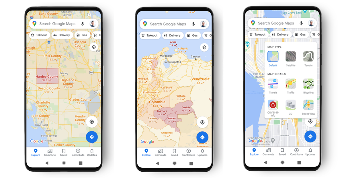
Google Maps will be receiving an update this week that shows users the prevalence of COVID-19 cases in an area, the tech company announced yesterday in a blog post.
Through an option selected within the application, Maps will display a color-coded overlay communicating seven-day averages of new cases per 100,000 in that area, as well as a general indication of whether or not local incidence is trending upwards or downwards.
The company said it's pulling this data from "multiple authoritative sources, including Johns Hopkins, The New York Times and Wikipedia," and that the trending data will be visible at the county level across all countries and territories supported by Google Maps. When applicable, the information will also be available at the state, province and city level.
WHAT'S THE IMPACT?
Local COVID-19 incidence and trends are key data points for individuals determining their personal level of comfort with public activities. Google Maps is already a frequent resource for billions of unique users worldwide, meaning that the mapping and navigation tool is well positioned to disseminate vetted public health information across a wide audience.
"While getting around is more complicated these days, our hope is that these Google Maps features will help you get where you need to be as safely and efficiently as possible," the company wrote on its blog.
THE LARGER TREND
Google has made efforts throughout the public health crisis to collect and spread COVID-19 information to the public and to decision-makers.
For the former, the company has adjusted its well-used search engine to prioritize results from health authorities, and within Google Maps implemented alerts highlighting COVID-19 checkpoint restrictions, facility guidelines when traveling to a healthcare facility and historic busyness trends to promote social distancing on public transit. The company has also been publishing regular community mobility reports based on location-tracking data since April to help inform policymakers.
By no means is Google the only Silicon Valley giant looking to tackle the pandemic with technology. It and Apple made waves when they teamed up to develop Bluetooth contact tracing and put it into their operating systems, a technology that is increasingly being adopted by public health authorities. Nor is Google the only tech giant looking to map out its stores of data for public health benefits. Facebook announced a similar project focused on describing colocation, movement and social interaction back in April.


